With the new EASA EFB rules approved and in force from 09 February 2014 it is interesting to see what is available for our proficient pilots.
Garmin is a well known company for its GPS navigation software products. Garmin has announced that “Garmin Pilot” will soon offer premium features for those flying in Europe, including weather, navigation data, charts, plates and more.
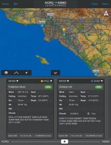
Garmin Pilot allows you to quickly and easily annotate approach plates so you can highlight approach minimums, runways, or jot down notes like frequency assignments and squawk codes. Split screen capability allows the pilot to simultaneously view the moving map and choose between another view like traffic or charts.
Highly configurable interactive maps now enable pilots to customize the moving map display on Garmin Pilot. Map color, visibility range, label sizes for airports, NAVAIDs and more, may be tailored to pilot preference so important information pertaining to each flight is always in view. Faster map rendering and the ability to zoom in tighter allows pilots to easily view frequency information, chart and obstacle text, ensuring nothing is overlooked throughout each flight.


With Garmin Pilot, declutter your cabin and cut down on the amount of paper you need for navigation. A wealth of electronic flight bag capabilities allow you to view paper charts and approach plates right on your device. Dynamic navigation maps allow you to filter charts by manually turning on or off different airspaces, airports and other features, as well as track up to your current aircraft heading. Split screen capability allows the pilot to simultaneously view the moving map and choose between another view like traffic or charts.
Using your device’s built-in GPS receiver, Garmin Pilot provides full enroute navigation on the rich, interactive moving map. The Panel Page provides situational awareness, including a graphical HSI directional display and indicators for groundspeed, altitude, rate of turn and vertical speed. With the addition of the GDL 39 3D, the HSI page adds an attitude indicator.
A unique Radial Menu provides easy onscreen access to create a user waypoint or navigate Direct-To, as well as view current weather conditions and airport/navaid information at a glance. The app also automatically keeps track of your ETE, ETA, crosstrack error, distance to waypoint, current position and much more.
A terrain and obstacle database provides high-resolution contour mapping to show your aircraft’s proximity to potentially hazardous terrain or obstacles like towers, as well as provide visual cautions and warnings as you near these obstructions.
Try the app free for 30 days. Available for Ipad and Android tablets.

Comments are closed.